
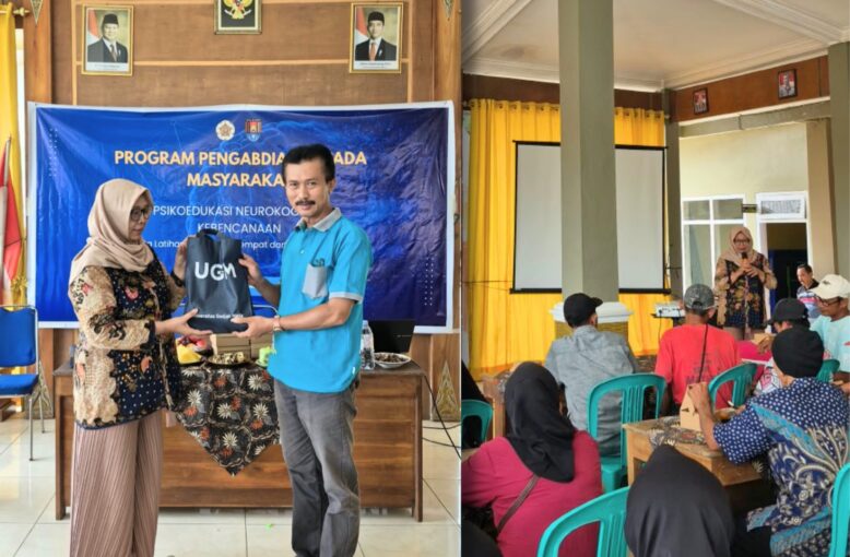
Cilacap. A total of 45 residents of Cibeunying Village, Majenang District, Cilacap Regency, gathered at the Cibeunying Village Hall on Saturday (October 24) to practice remembering places and recognizing routes. The activity, titled “Training in Place Memory and Route Recognition and Neurocognitive Disaster Psychoeducation,” was organized by the Behavioral Neuroscience Expertise Group (KBK) of the Faculty of Psychology, Universitas Gadjah Mada (UGM), in collaboration with the Cibeunying Village Government. The program was part of the Faculty of Psychology UGM’s 2026 Community Service Grant.
Participants completed route-learning exercises on laptops before attending a session on how the brain remembers routes and how to prepare for natural disasters. The event was attended by Cibeunying Village Head Lili Warli, who delivered the opening remarks. He expressed his appreciation to the UGM Faculty of Psychology team and emphasized the importance of training to help affected residents adapt to their new surroundings.
A landslide in Cibeunying buried houses and altered footpaths in Tarukahan and Cibuyut hamlets. Some families now live in temporary shelters (huntara) at new locations. For residents, these changes mean that familiar landmarks used for years to navigate their surroundings, such as neighbors’ houses, trees, and road bends, are no longer there.
“Natural disasters, such as earthquakes and landslides, can change familiar spatial environments that people have known for years. This can happen when landslides or other natural materials bury or wash away existing features, block roads, and alter routes to familiar locations. Panic and fear during such events can also interfere with spatial memory. Therefore, knowledge of locations, navigation, and spatial memory is essential. This community service program aims to educate affected residents about the importance of spatial memory and the role of the brain in navigation and spatial memory,” said the team leader, Dra. Sri Kusrohmaniah, M.Si., Ph.D., Psikolog.
Laptop-Based Route Training
The morning session began with two tasks developed by the team: the adapted Goal-Monitoring Learning Task (GMLT) paradigm and the adapted Target Chasing Task (TCT) paradigm. In the first task, participants had to find a hidden route on a grid displayed on a screen by clicking one square at a time, then repeat the same route five times. In the second task, they had to follow a yellow square as it moved to different positions. Facilitators read the same instructions to all participants, emphasizing that the activity was neither an examination nor an IQ test or health assessment. Individual results would not be announced, and participants were free to take a break or stop at any time. They were also reminded that making mistakes was normal, especially during the initial attempts.
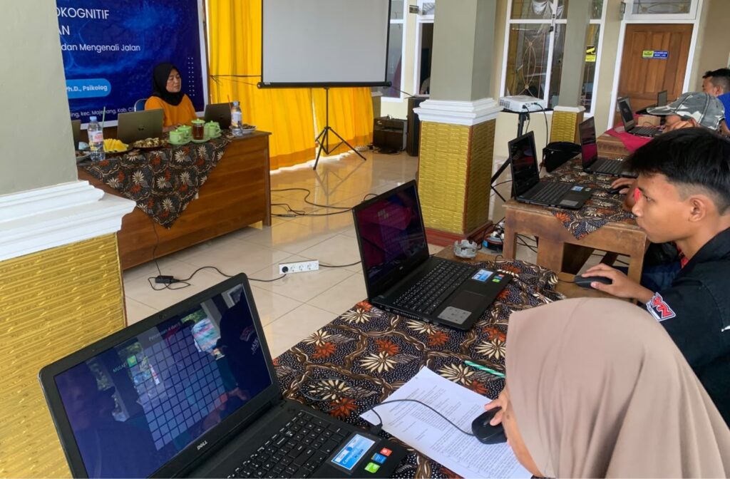
Preliminary results showed that participants improved with practice. The average number of errors decreased from approximately 32 clicks on the first attempt to around 17 clicks on the fifth attempt. The team noted that most participants had never used a computer mouse or similar device before, making the exercise a new opportunity to gain digital skills.
Psychoeducation: The Brain Does Not Work Like a GPS
In the following session, Sri Kusrohmaniah explained two ways people remember routes: from their own perspective and from a bird’s-eye view, as if looking at a map. She also explained that several brain regions work together when people navigate their surroundings. Thus, the brain does not function like a GPS. She emphasized that no group is inherently better prepared for natural disasters, as preparedness develops through practice.
The materials were delivered through easy-to-remember strategies. To help residents identify routes around their temporary shelters, the speaker introduced and demonstrated four steps: Recognize, Practice, Simulate, and Evaluate. These included instructions on creating sketches of primary and alternative routes. The speaker also introduced the Look-Cover-Describe-Check technique to strengthen route memory, as well as Drop-Cover-Hold On as an appropriate response during ground shaking.
Residents’ understanding was assessed through 15 multiple-choice questions administered before and after the session. The average score increased from 8.97 to 10.27. The greatest improvement was observed in responses to a question about the first action to take when strong shaking occurs inside a house: the proportion of correct answers increased from 37% to 77%.
Understanding of how to create and practice routes around temporary shelters showed a smaller improvement. Since the Recognize-Practice-Simulate-Evaluate steps had only been demonstrated by the speaker, the team plans to prepare printed modules and instructional videos based on local maps so residents can practice independently in their living environments.
“We are grateful that residents were given the opportunity to learn through an approach that was easy to understand. We hope this collaboration will continue, particularly in helping residents living in temporary shelters identify evacuation routes,” said Cibeunying Village Head Lili Warli.
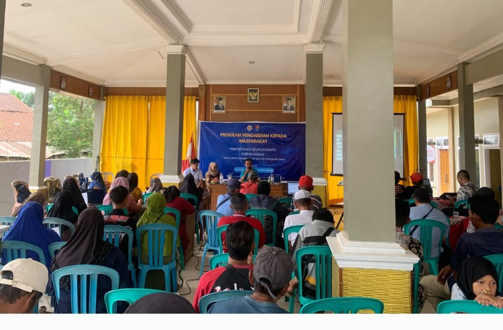
The activity concluded with closing remarks from Lili Warli, who once again encouraged residents to practice identifying routes and familiar landmarks in their new surroundings.
Supporting SDGs 3, 4, and 11
This program contributes to three Sustainable Development Goals (SDGs).
Under SDG 3: Good Health and Well-being, the activity introduced non-clinical approaches to maintaining brain health and memory after natural disasters. Under SDG 4: Quality Education, psychoeducation sessions, printed modules, and instructional videos aim to expand residents’ access to science-based disaster literacy. Meanwhile, SDG 11: Sustainable Cities and Communities is supported by equipping residents with the knowledge and skills to identify new routes and landmarks, helping them adapt to post-relocation settlements and strengthening community disaster preparedness.
The collaboration between the UGM Faculty of Psychology and the Cibeunying Village Government is currently being formalized through a community service cooperation agreement. The activity also received support from a lecturer at Universitas Amikom Purwokerto, who served as a liaison partner.
All results were reported collectively without disclosing residents’ identities. A summary of the findings will be submitted to the Village Government to support further assistance for the community.
Author and Photo: Muh. Nur Haq I. S. Mannesa, S.Psi., M.A.